
Rachel Whitney, Curator, Sapulpa Historical Museum
Route 66, Will Rogers Highway, The Mother Road, The Main Street of America, The Most Famous Highway in the World, The Road of Dreams. Tulsa, the Capital of Route 66. Sapulpa, Crossroads of America.
Highway US 66 earned its moniker The Main Street of America “due to its central role in American transportation and culture. The road connected countless small towns and businesses across the country, making it a symbol of American small-town life.”
The 100th anniversary of Route 66 is nearing in a couple of years, November 11, 1926-2026. “Despite its decommissioning in 1985, Route 66 remains an iconic emblem of exploration and the American trip. It just might be ‘The Most Famous Highway in the World.’”
In just a few years, the Great Depression took over the world, and the Dust Bowl covered the Midwest. People began moving east to west, looking for jobs and a place to call home for their families.” The iconic highway represented a path to a brighter future for countless Americans seeking jobs and prosperity in the West. Its rich history, captivating landscapes, and cultural significance continue to inspire dreams of adventure and exploration.”
“‘Route 66 was called the Road of Dreams, and it was. It really was.’”
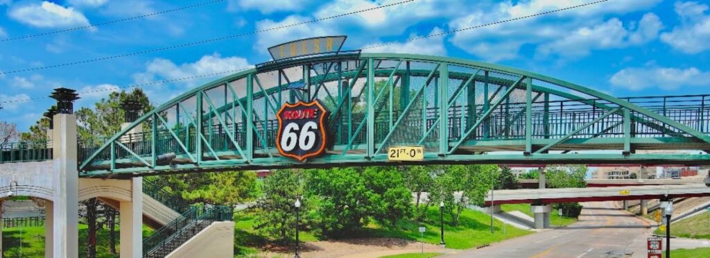
“With 28 miles of The Mother Road, Tulsa is known as the Capital of Route 66. Route 66 has much of its origins in Tulsa, with Cyrus Avery, a Tulsan, being known as ‘The Father of Route 66,’ for his role in the road’s creation.”
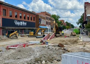
“Sapulpa has long been known as ‘The Crossroads of America,’ sitting at U.S. Highway 66 and U.S. Highway 75. Before interstate highways were constructed, Route 66 was the main east/west highway of the western United States, and U.S. 75 was the main north/south highway, running from Canada to the Gulf Coast at Galveston, Texas. Today, the city is still a major crossroad as five major highways converge in the town.”
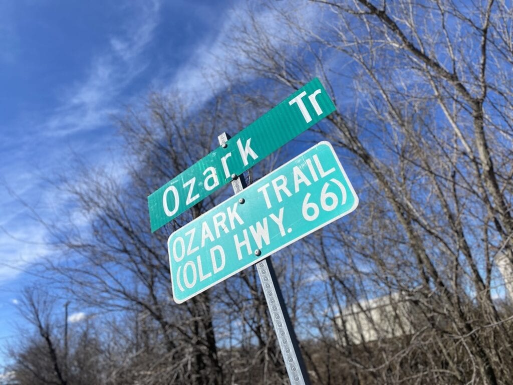
A decade before the infamous highway crossed Oklahoma, the Ozark Trail Highway connected the towns. “In 1913, an Arkansas tourism entrepreneur, William Harvey, created the Ozark Trail Association.” Its goal was to connect St. Louis, MO and Las Vegas, NM. “The Ozark Trail Highway was a short-lived but significant cross-country transportation artery that existed in name from 1915 to 1926.”
“The Ozark Trail Highway had several proposed routes, the most important of which would pass through the Oklahoma towns of Sapulpa, Depew, Bristow, Stroud, Davenport, Chandler, Wellston, Luther, Arcadia, and Oklahoma City. Other routes would substitute Tulsa, Henryetta, Okemah, and Prague to Oklahoma City.”
“The Sapulpa to Oklahoma City line proved the most traveled and prevailed.”
However, where is the Sapulpa stretch of Ozark Trail Highway? When and where did it begin in Sapulpa’s history?
Around the statehood of Oklahoma, the backroad in Sapulpa that would later become a piece of Ozark Trail and Route 66 history was named the Lowdermilk Road*.
*Notice: both newspapers and city directories referred to the name as Lowdermilk spelling and Loudermilk spelling.
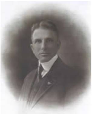
In September 1910, the first election under the new commission form of government had been held. Those elected to office were: J.O. Denton as mayor with Commissioners J.E. Rice, G.E. Lowdermilk, and J.F. Murphy. George E. Lowdermilk was Commissioner of Public Works.
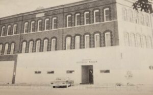
Lowdermilk helped build and resolve water issues, especially during the drought months of the summer 1911. He lived at 211 E Lee Ave with his wife Etta. His office was at the building on the corner of Lee Ave and Park St, the Lowdermilk Building at 21-23 S Park.
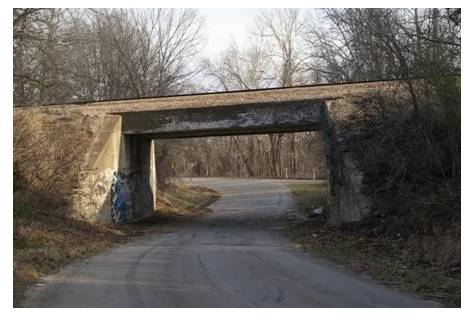
This week in Sapulpa history, on June 6, 1911, the Lowdermilk Road received notice it would be expanded.
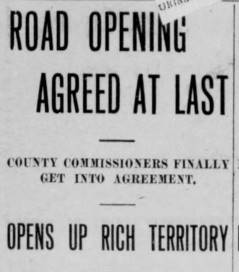
The landowners had filed an injunction against the county until they reached an agreement. “The road must be opened within the next twenty days,” the County Commissioners and landowners agreed.
“The opening of this road will be a big advantage to Sapulpa, as it opens the community west of here where there is a rich farming vicinity. The road is three and a half miles long and follows the Frisco right-of-way.”
Today, this stretch of road is the only remainder of the old trail, as it follows along just north of Veterans of Foreign Wars (VFW) and Tee Pee Drive-In, and just south and following Euchee Creek, going west and under the railroad underpass on Ozark Trail, and ends just before the Crosstrails RV Park.
(Sapulpa Evening Light, June 6, 1911; Oklahoma Historical Society; TakeMyTrip.com; Route66RoadMap.com; CityofTulsa.org; LegendsofAmerica.com; Wikipedia; Oklahoma National Park)
Editor’s Note: Read more about the Ozark Trail’s origins in our other reporting here, and our story about the condition of the road here.


