
Sapulpa is famous for a lot of things, but probably none more so than our location on Route 66. The intersection of Dewey Avenue and Main Street is of particular importance due to its designation as “The Crossroads of America” where Route 66 and (the original) Highway 75 intersect. Though many of us drive through it every single day with little thought, make no mistake—it’s a big deal.
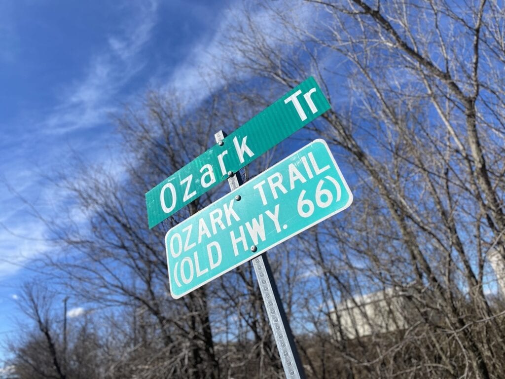
When your town has such a big landmark right at the heart of it, it can be easy for other important trails or roadways to get missed, but Sapulpa has more than just one famous roadway. In fact, Sapulpa has another roadway even older than The Mother Road: Ozark Trail.
The Ozark Trail could be considered something of an interstate highway before the United States federal highway system was even created. Organized by the Ozark Trails Association, the Ozark Trail is a network of locally-maintained roads and highways that run from St. Louis, Missouri to El Paso, Texas, over a number of routes.

Created in 1913, the Ozark Trail Association was created by Arkansas tourism entrepreneur William “Coin” Harvey in order to promote an improved highway from St. Louis to Las Vegas. Cyrus Avery, known as “the Father of Route 66,” helped organize the Oklahoma branch of the OTA in 1914. There were several proposed routes, the most traveled of which would pass through Sapulpa, Depew, Bristow, Stroud, Davenport, Chandler, Wellston, Luther, Arcadia, and Oklahoma City; eventually, this stretch of the trail would be redesignated in 1926 as Route 66.

The Trail was popular and well-traveled, but not always easy or smooth. Often, the route followed section-line roads and had a right-angle turn every mile, making for a slow, arduous journey. In the years after World War I, sections of the road were paved with asphalt, concrete, or even brick, usually funded by local and county bond issues. The route was originally marked by telephone poles that had been painted green and white. Later, the OTA erected tall, white markers with pyramidal tops and green directional lettering to point travelers on their way. The highway had various diversions in its route, leading to confusion among motorists. OTA eventually had to provide a book with turn-by-turn directions to help reduce the amount of lost travelers. You can still find one of the Ozark Trail highway markers just west of Stroud in Lincoln County.
Sapulpa’s section of the Ozark Trail officially starts just before you hit the intersection of Hwy 66 and Hwy 117/Taft Ave while traveling west on Hwy 66. Because this section of Ozark Trail is actually part of the original Route 66 alignment, it contains the historic Rock Creek Bridge, which is already a popular stop for those traveling Route 66. There are plans underway to paint the large white water tower that sits east of Rock Creek, providing another photo-op for travelers. Continuing east you’ll see the TeePee Drive-In, which is currently undergoing renovations after being purchased by The Kante Group in early March. There are also plans as part of the 2020 GO Bond to extend Hwy 117/Taft Ave from where it stops now at Hwy 66 to Ozark Trail, providing a faster route for emergency vehicles to reach houses that live down this road.
Ozark Trail is a rough ride that runs for another three miles, with train tracks on one side and houses and intersecting roads on the other. It’s a quiet drive with little to offer except potholes and the notion that you’re driving on history. It passes under a short railroad overpass that dates back to 1925. Shortly thereafter the section ends, and you reconnect with Hwy 66. There are two other sections of the Ozark Trail that can be found off Hwy 66 before you hit Bristow.